Cardiff and South Wales National rail Map PDF – Overview
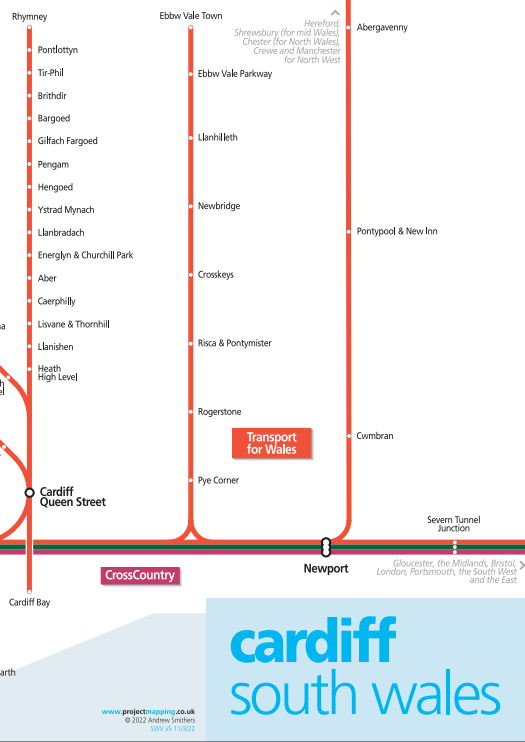
Cardiff and South Wales National rail Map is a Schematic map showing all routes in this area. It includes Airport interchange, Train Operators.
Cardiff Central railway station is a major station on the South Wales Main Line, located in the capital of Wales, Cardiff. It is one of the city’s two urban rail network hubs, along with Cardiff Queen Street. Opened in 1850 as Cardiff station, it was renamed Cardiff General in 1924, and then Cardiff Central in 1973.
Cardiff and South Wales National rail Map
Cardiff & South Wales Valleys area
Schematic map showing all routes in this area.
- All train operators are shown.
- All routes shown.
- All stations shown.
Last updated: 15 March 2022
Train Operators in Cardiff & South Wales Valleys
- Transport for Wales
- Great Western Railway
- Cross Country
Also Download
London Tube Map
Railway Map UK
Download Cardiff and South Wales National rail Map PDF from www.nationalrail.co.uk using the direct download link given below.


2 thoughts on “Cardiff and South Wales National rail Map”